Validating HD Map Localization Accuracy for AVs
Around the development of autonomous transport, there is a widespread opinion that a self-driving car navigates in space exclusively by reading the road situation with cameras and sensors in real-time. In reality, the safe movement of robocars is almost impossible without the use of HD maps, which play the role of a kind of "digital rails". Such a map acts as reliable prior knowledge or a powerful virtual sensor containing a complete three-dimensional model of the road infrastructure. It prompts the artificial intelligence in advance about the exact location of road signs, lane boundaries, traffic lights, and curbs, allowing the system to confidently make decisions even when the actual view of the physical sensors is completely blocked by a large truck or limited by dense fog.
For a deep understanding of autonomous driving architecture, it is important to clearly distinguish between the concepts of navigation and localization, which perform fundamentally different tasks. Classic satellite navigation, familiar to most from apps like Google Maps, operates with macro-coordinates and a global route, notifying the system of an approximate approach to a turn a few dozen meters away with an acceptable error of 3–5 meters. In contrast, micro-localization in AVs is responsible for the extremely precise positioning of the vehicle within the current driving lane, down to the centimeter, to maintain a safe trajectory and prevent emergency situations.
Quick Take
- Localization in autonomous cars operates with micro-coordinates, determining the car's position relative to lane marking lines.
- When annotating accuracy, special attention is paid to lateral error, as it directly threatens a departure onto the roadside or the oncoming lane.
- Reliable localization is always a fusion of geometric data from LiDAR, visual markers from cameras, and inertial odometry from IMU+GNSS.
- Validating map freshness helps the AI react correctly to edge cases.
Main Types of Localization Errors in AVs
In order for an autonomous car to move safely, its internal algorithms must continuously compare data from real sensors with the layers of a high-precision map. Any discrepancy in this process is classified by specialists using localization accuracy annotation. If the system makes an error, it can lead to an incorrect calculation of the trajectory, so engineers clearly separate positioning failures into main categories.
Positioning Error
This type of failure occurs when a car incorrectly determines its physical coordinates in space, meaning it believes it is in one place when it is actually located in another. In such scenarios, sensor fusion algorithms incorrectly read the distance to surrounding objects or receive a distorted satellite signal. For driving safety, the specific plane in which this shift occurred is critical.
Evaluating this failure, engineers divide spatial errors into two directions:
- Longitudinal error. The car shifts forward or backward along its path of motion. Because of this, the autonomous vehicle may be late with braking and drive a meter past the stop line at an intersection.
- Lateral error. The car shifts left or right relative to the lane. This is the most dangerous subtype of error, as even a small deviation creates faulty lane line offset data, threatening a departure into the oncoming lane or hitting a curb.
Orientation Error
Unlike the previous problem, here the autonomous vehicle may correctly determine its exact point of location on the map, but it is mistaken about the heading angle of its body or the direction of movement. The car incorrectly calculates its heading relative to the axes of three-dimensional space. Since the car's movement is dynamic, an error in the heading angle leads to the car significantly deviating from the intended safe course after just a dozen meters.
Such a failure often happens due to inaccurate calibration of inertial sensors or cameras. For example, if the system believes it is turned strictly parallel to the road, but in reality the body is rotated slightly to the right, the car will begin to smoothly drift toward the roadside, believing it is driving straight. When creating an HD map validation dataset, such deviations are meticulously recorded to teach the artificial intelligence to correct its angular heading in time based on stationary landmarks like poles or buildings.
Error Accumulation
The drift effect is a specific problem that usually occurs in zones where the satellite signal disappears or degrades. For example, in tunnels, under multi-level bridges, or in underground parking lots. When direct coordinates from a satellite are unavailable, the AV system switches to a dead reckoning mode, relying exclusively on wheel rotation and acceleration sensors.
Since each sensor has a microscopic built-in error, with every meter of movement, these small inaccuracies add up. After a minute of driving in a closed tunnel without external landmarks, the car's virtual position on the map begins to smoothly "float" away from the real trajectory. To overcome this effect, engineers perform map freshness validation, adding unique geometric features of the tunnel walls to the digital layers, by which the LiDAR can instantly reset the accumulated error to zero.
Data Used for Localization Validation
In order to verify whether an autonomous car correctly determines its position in space, engineers need a comprehensive set of input data. The testing process is based on a constant comparison of what the car sees right now with what is recorded on the map and with the reference indicators of measuring instruments. This entire mass of information, which forms the HD map validation dataset, can be divided into three key categories.
Sensor Data
This is real-time information that the car reads directly while moving. It reflects the current physical state of the environment around the vehicle.
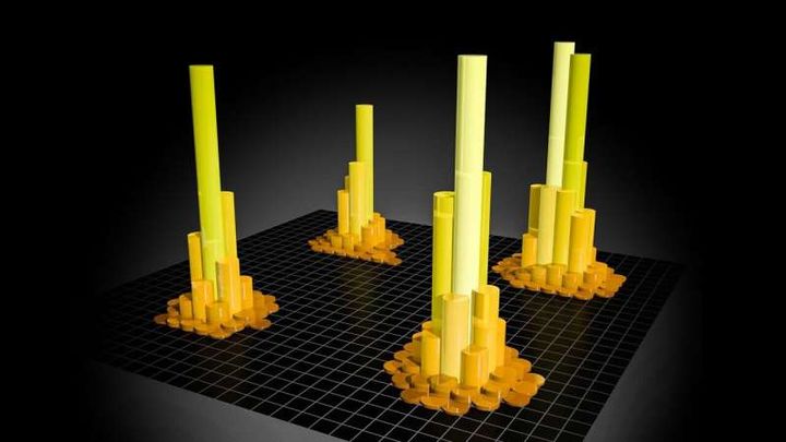
- LiDAR point clouds. Millions of laser reflections create a precise three-dimensional copy of the space around the AV every second. This data is the basis for geometric matching with the map, as LiDAR clearly captures volumetric objects – building walls, poles, curbs, and trees.
- Camera frames. A high-resolution video stream that allows for the recognition of visual road elements. Cameras are critically important for reading textures, such as the color and type of lane markings, inscriptions on the asphalt, and digits on road signs, ensuring precise lane line offset data.
- Radar returns. Data from radar sensors, which, unlike cameras and LiDARs, operate stably in all weather conditions. Radars help verify the distance to large metallic and concrete infrastructure objects when other optical sensors go "blind".
Map Data
This is the digital foundation loaded into the car's memory. It contains pre-collected and perfectly labeled information about the road section on which map freshness validation is being conducted.
- Lane boundaries. Detailed digital lines describing the trajectory and width of each driving lane, including virtual centerlines, stream merging zones, and safety islands.
- Landmarks. Unique, stationary objects on the road that have clear geodetic coordinates. They are used by algorithms as reference points for "anchoring" the car to the terrain.
- Road geometry. A complete three-dimensional model of the roadbed, which includes information about micro-relief, turn slope angles, the presence of inclines, declines, curbs, and elevation drops.
Ground Truth
This is the independent "absolute truth" – ultra-precise spatial coordinates against which the output of the AV's onboard computer is compared during testing. They are collected by separate professional equipment.
- RTK GPS. A high-precision satellite positioning system that uses additional ground-based base stations to correct the conventional satellite signal. This allows for obtaining the spatial coordinates of the test car in real-time with an error of no more than 1–2 centimeters.
- Reference measurement systems. Specialized autonomous complexes combining high-end military inertial sensors and optical odometers. They are installed on the car strictly during the testing stage for the independent recording of an ideal trajectory to perform localization accuracy annotation and detect hidden errors in autopilot algorithms.
Multi-sensor Fusion
In the real world, no single sensor is capable of ensuring continuous, accurate positioning of an autonomous car. Satellite communication disappears in tunnels, cameras go blind from direct sunlight, and LiDARs lose efficiency during pouring rain. That is why reliable localization in the AV industry is built on the concept of multi-sensor fusion – the intelligent combination and cross-verification of information from different sources.
Concept and Mathematical Logic of Fusion
The fundamental idea of multi-sensor fusion is that the autonomous vehicle's onboard computer considers each sensor through the prism of its weight matrix right now. Using complex mathematical algorithms, the system instantly weighs data from all sensors. If one of the devices begins to send noisy or contradictory information, the system automatically reduces its influence on the final decision, preventing autopilot failures.
This process continuously generates data for humanoid task planning and AV control systems, creating a single, consistent picture of the world. Sensor fusion allows for compensating for the physical shortcomings of some devices through the strengths of others. For example, the high update frequency of an inertial system perfectly smooths out the low update frequency of satellite coordinates.
Key Data Fusion Combinations
To ensure precision within the whole-body control training of the vehicle, engineers combine sensors into three main operational pairs:
- LiDAR + Map (Geometric matching). The algorithm takes the current three-dimensional point cloud from the LiDAR and overlays it onto the 3D layer of a high-precision map. By looking for matches in the geometry of stationary objects, the car determines its exact position.
- Camera + Map (Visual matching). Cameras capture textural elements of the road, such as road markings, arrows on the asphalt, or signs. The system matches these elements with the map, which makes it possible to detect a microscopic shift of the car and obtain up-to-date lane line offset data to keep the car strictly in the center of the lane.
- IMU + GNSS (Dynamic odometry). A satellite system with RTK support provides the basic absolute coordinates of the car on the planet. An inertial module measuring acceleration and body tilt angles backs up the satellite. If the car drives under a bridge where GNSS disappears, the pair of IMU and wheel rotation sensors continues to precisely "guide" the car along the map until communication is restored.
The Role of Annotation in Multi-sensor Fusion Validation
Verifying the operability of such a complex system requires a special approach to the preparation of test datasets. When engineers perform map discrepancy labeling, they deal with situations where sensors contradict each other. For example, during roadworks, the LiDAR sees new concrete blocks that are not yet on the base HD map.
Highly qualified annotators manually label such complex scenarios in the HD map validation dataset, creating construction zone annotations. They indicate to the algorithms exactly in which situations they should ignore outdated map layers and temporarily trust exclusively real-time LiDARs and cameras. Such validation guarantees that the multi-sensor fusion system can flexibly and safely adapt to any dynamic changes on the road.
FAQ
Why can't regular Google Maps or Apple Maps be used for autonomous car localization?
Regular navigation maps are created for human drivers and have an error ranging from several meters to a dozen meters, which is absolutely unacceptable for autopilot operation. They contain only general road contours and street names, whereas HD maps are highly accurate three-dimensional digital prints of infrastructure with high precision. An HD map contains the exact geometry of every curb, lane boundaries, the height of traffic lights, and even 3D models of surrounding poles for LiDAR anchoring.
What is the ICP algorithm, and how is it related to HD maps?
The ICP algorithm is a mathematical method used to align two different three-dimensional point clouds. In the context of AV localization, this algorithm takes the "raw" point cloud that the car's LiDAR is scanning right now and attempts to overlay it as accurately as possible onto the reference 3D point cloud that is already pre-recorded in the HD map layer. By finding the ideal mathematical combination of these two clouds, the car instantly calculates its exact spatial coordinates relative to the road.
How do snowfall or heavy rain affect the process of map-based localization?
Bad weather severely complicates the operation of optical sensors: snow covers road markings, making cameras useless, while raindrops or snowflakes create heavy noise in the LiDAR point cloud. In such conditions, the multi-sensor fusion system automatically reduces the "weight" of cameras and LiDAR and begins to trust radar returns and the inertial system more. The AI also uses the HD map as a hint: even if the markings are not visible under the snow, the car "knows" their virtual location thanks to anchoring to uncovered landmarks – signs or bridge pillars.
What happens if the lane markings on a section of the road have changed due to repairs, but the HD map has not been updated yet?
This is a classic case of a map-to-reality discrepancy. If the car sees a new yellow dashed marking that contradicts the white line on the HD map, the safety algorithm must record an anomaly. Thanks to training on construction zone annotation, modern AV systems dynamically reduce the level of trust in the map in such situations and switch to a mode of driving according to the actual situation, using cameras to track new temporary lines and traffic cones.
How often should map freshness validation be conducted in real vehicle fleets?
The update frequency depends on the dynamism of a city's infrastructure: central avenues of megacities and active construction zones require daily verification, whereas suburban highways can remain unchanged for months. Leading AV companies use the concept of a "fleet as a data collector". Each autonomous car automatically compares reality with the map during a trip, and if several cars in a row record a persistent discrepancy, the system automatically sends a report to the server for targeted redrawing of that map section.
In what way do simulators (CARLA or NVIDIA Drive Sim) help in localization validation?
In a simulator, engineers have access to the so-called ideal ground truth – the computer knows the exact coordinates of the virtual car because it generates them itself. This allows for artificially creating extreme scenarios that are difficult or dangerous to catch on real roads: for example, a severe dust storm, a sudden LiDAR failure at speed, or complete jamming of the GPS signal by malicious actors. By comparing how the localization algorithm handles this in simulation, engineers find weak points in the code prior to heading out for real tests.


Comments ()