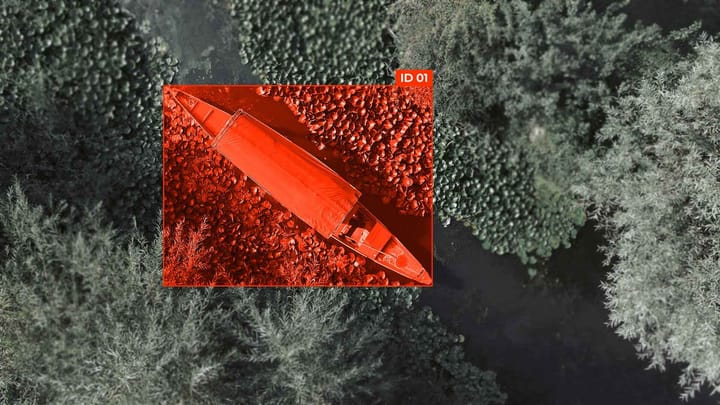
Road & Lane Segmentation Annotation: Pixel-Perfect Road Boundary Labeling

To effectively train deep learning models, high-quality annotations are required that provide pixel-precise road and lane markings. Accurate lane boundary annotation enables models to correctly identify lane boundaries even in complex traffic situations — at intersections, on curved road sections, and during roadway narrowing.
Correct drivable area segmentation and road marking detection increase the accuracy of autonomous vehicle navigation and ensure safe traffic in real-world conditions.
End-to-end workflow at a glance: from raw images to deployable lane models
Creating the right dataset
A good dataset is the foundation for effective road and lane segmentation models. Building a good dataset involves several key steps that ensure high accuracy in lane boundary annotation, drivable area segmentation, and road marking detection.
- Data selection: A variety of road conditions, road types, weather conditions, and time of day should be provided.
- Annotation and quality control: Pixel-precise lane and roadway annotation, as well as road marking detection, with validation of annotation accuracy.
- Data augmentation: Increasing the amount of data and improving the robustness of models by changing lighting, rotation, reflection, and scaling.
- Class balancing: Ensuring uniform representation of different road, lane, and road marking types to avoid model bias.
- Set partitioning: Dividing the dataset into training, validation, and test sets to correctly evaluate model performance.
High-accuracy lane boundary annotation, reliable drivable area segmentation, and efficient road marking detection ensure stable operation of models in real-world conditions and increase the safety of autonomous transportation systems.
Pixel-perfect labeling techniques for road boundaries and lanes
Choosing the right approach: semantic segmentation, instance segmentation, or hybrid detection
- Semantic Segmentation. Designed to classify each pixel of an image. Ideal for drivable area segmentation and road marking detection, where a clear map of roads and traffic zones is important.
- Instance Segmentation. Separates individual objects of the same category. Used when it is necessary to distinguish specific lanes or individual elements of road markings (lane boundary annotation).
- Hybrid Detection. Combines semantic and instance segmentation approaches to obtain a more accurate and detailed map of the scene. Allows you to simultaneously segment the roadway and recognize individual lanes and road markings.
Model benchmarking and selection using clear metrics
Summary
Creating high-quality models for lane boundary annotation, drivable area segmentation, and road marking detection requires a systematic approach that spans from raw data collection and pixel-precise annotation to model training, evaluation, and deployment.
Key success factors include: accurate data labeling, the right choice of segmentation approach (semantic, instance, or hybrid), the use of reliable metrics for benchmarking, and consideration of resource constraints during implementation.
A high-quality dataset, structured workflow, and informed model selection ensure high-accuracy road and lane segmentation in complex road conditions and increase the safety of autonomous transportation systems.
FAQ
What is lane boundary annotation?
Lane boundary annotation is the pixel-level labeling of lane edges on roads. It ensures models accurately detect lane positions for safe autonomous navigation.
Why is drivable area segmentation important?
Drivable area segmentation identifies all regions suitable for vehicle movement. It helps autonomous systems navigate safely by distinguishing between roads and non-drivable zones.
What is road marking detection used for?
Road marking detection identifies lines, arrows, and other markings on the road surface. It improves lane keeping and compliance with traffic rules in autonomous driving.
Which dataset characteristics ensure high-quality lane boundary annotation?
Datasets must include diverse road types, weather conditions, lighting, and complex intersections. Balanced and annotated images improve model generalization.
What distinguishes semantic segmentation from instance segmentation?
Semantic segmentation classifies pixels by category, while instance segmentation separates individual objects within a given category. Semantic segmentation is ideal for drivable areas; instance segmentation is useful for individual lanes.
What role does mask refinement play in pixel-perfect labeling?
Mask refinement improves initial annotations by correcting edges and removing noise. This enhances the accuracy of lane boundary annotation and drivable area segmentation.
Which metrics evaluate model performance for lane and road segmentation?
IoU, F1-score, precision, and recall measure segmentation accuracy, while inference time and model complexity assess efficiency. High metrics ensure reliable lane boundary annotation and road marking detection.
What is the benefit of hybrid segmentation approaches?
Hybrid approaches combine semantic and instance segmentation to achieve precise pixel-level maps. They improve lane boundary annotation and detect drivable areas with higher accuracy.
Why is dataset augmentation critical for drivable area segmentation?
Augmentation increases data diversity, including variations in lighting, rotation, and weather. This helps models generalize to unseen real-world conditions.
What factors influence model deployment for lane and road tasks?
Deployment depends on latency, resource availability, and model size. Optimized models maintain high accuracy for lane boundary annotation, drivable area segmentation, and road marking detection in real-time systems.


Comments ()